idekCTF 2022 - NMPZ Challenge
This Weekend I participated in the idekCTF. One of the OSINT challenges I worked on was called NMPZ and revolved around essentially playing a more involved game of Geoguessr. The challenge consists of 17 different images of google street view panoramas, to which one has to figure out the countries the respective images were taken in. Once all the countries have been succesfully identified, the flag is composed according to the following rules:
- The first letter of every country’s name will create the flag.
- Countries with over 10 million inhabitants will have a capital letter.
- Countries with less than one million inhabitants become an underscore.
Example: idek{TEST_flAg} can be composed from the following countries:
| Picture | Country | Letter |
|---|---|---|
| 1.png | Turkey | T |
| 2.png | Ecuador | E |
| 3.png | Spain | S |
| 4.png | Thailand | T |
| 5.png | Vatican City | _ |
| 6.png | Finland | f |
| 7.png | Lithuania | l |
| 8.png | Argentina | A |
| 9.png | Georgia | g |
I am certainly no rainbolt, so naturally I turned to the best geoguessr player I know personally: my brother. And so, we teamed up to beat this challenge!
Let’s play some Geoguessr!
We’ll go through the pictures roughly in the order we have solved them.
1.png
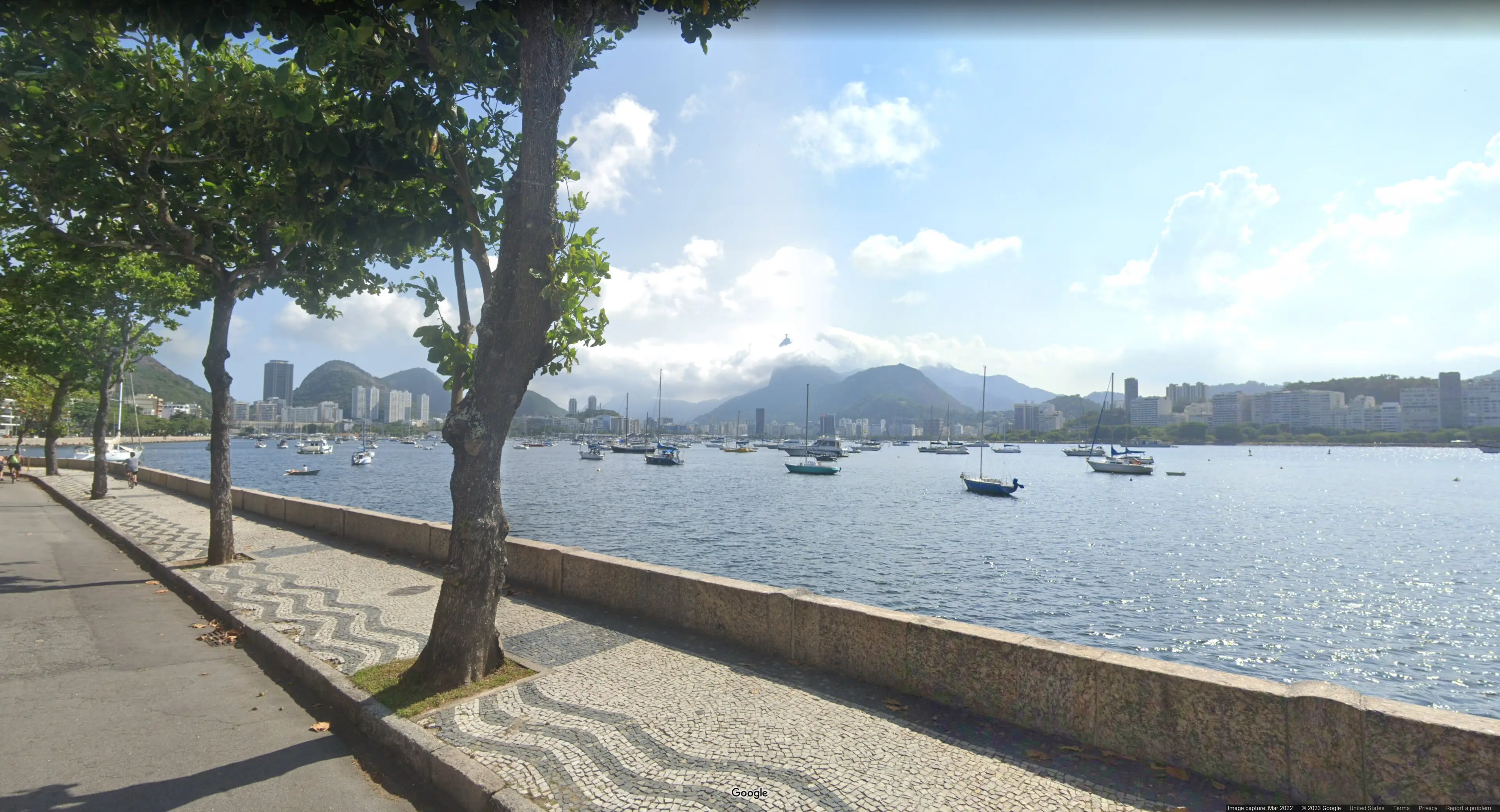
This one looked very unassuming at first sight. But a closer look at one of the mountain peeks in the picture reveals:
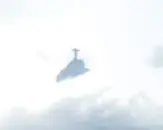
This made me immediately think of the Jesus Statue in Rio De Janeiro in “Epic T-Pose Man Country” aka. Brazil. Going on google streetview in Rio De Janeiro produces close enough results for me to consider this a case closed. This image must have been taken in Rio De Janeiro. The first country is Brazil.
2.png
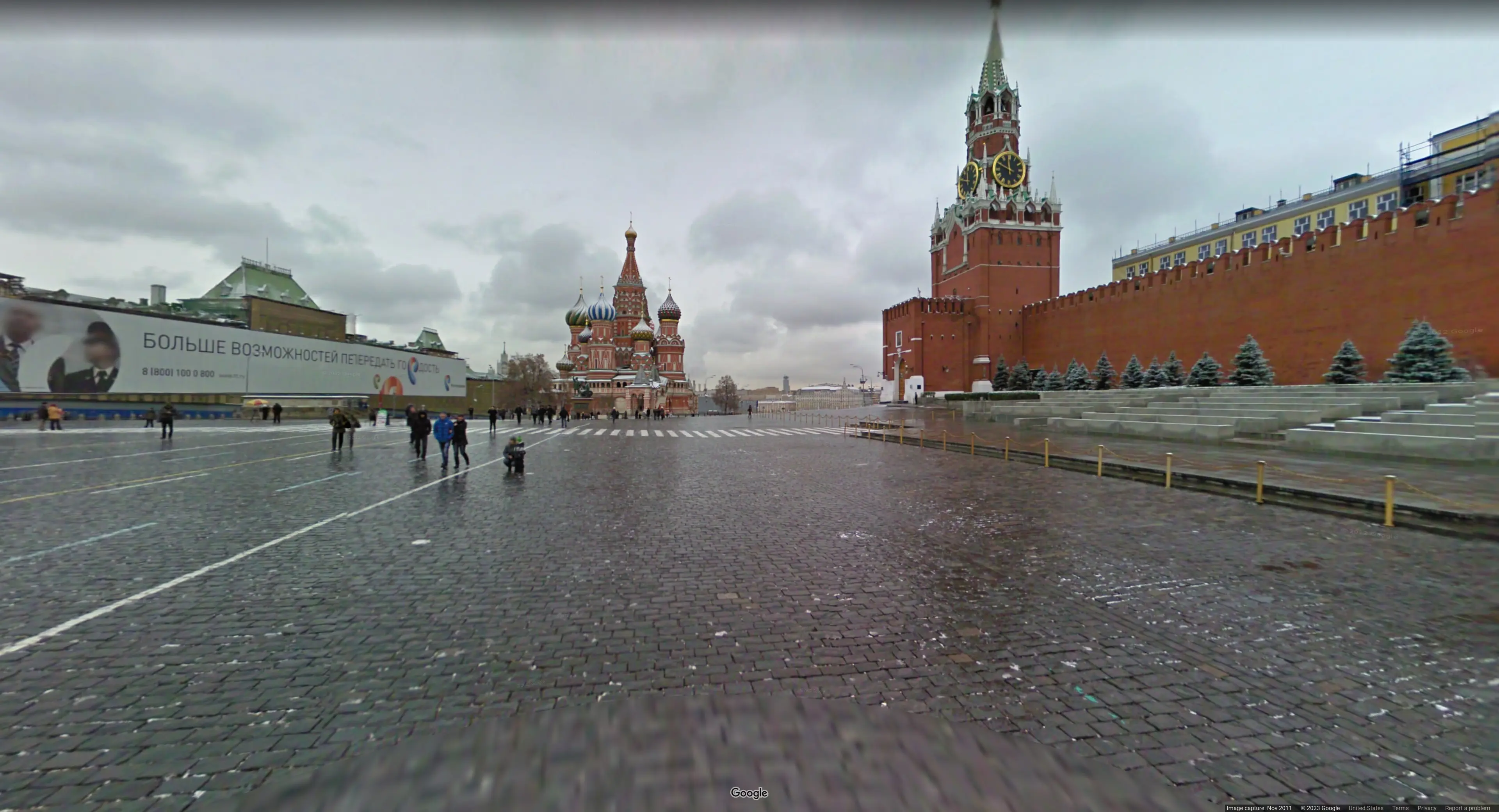
The clearly visible cyrillic script, as well as the iconic architecture of the Saint Basil’s Cathedral identifies this as Moscow, Russia.
3.png
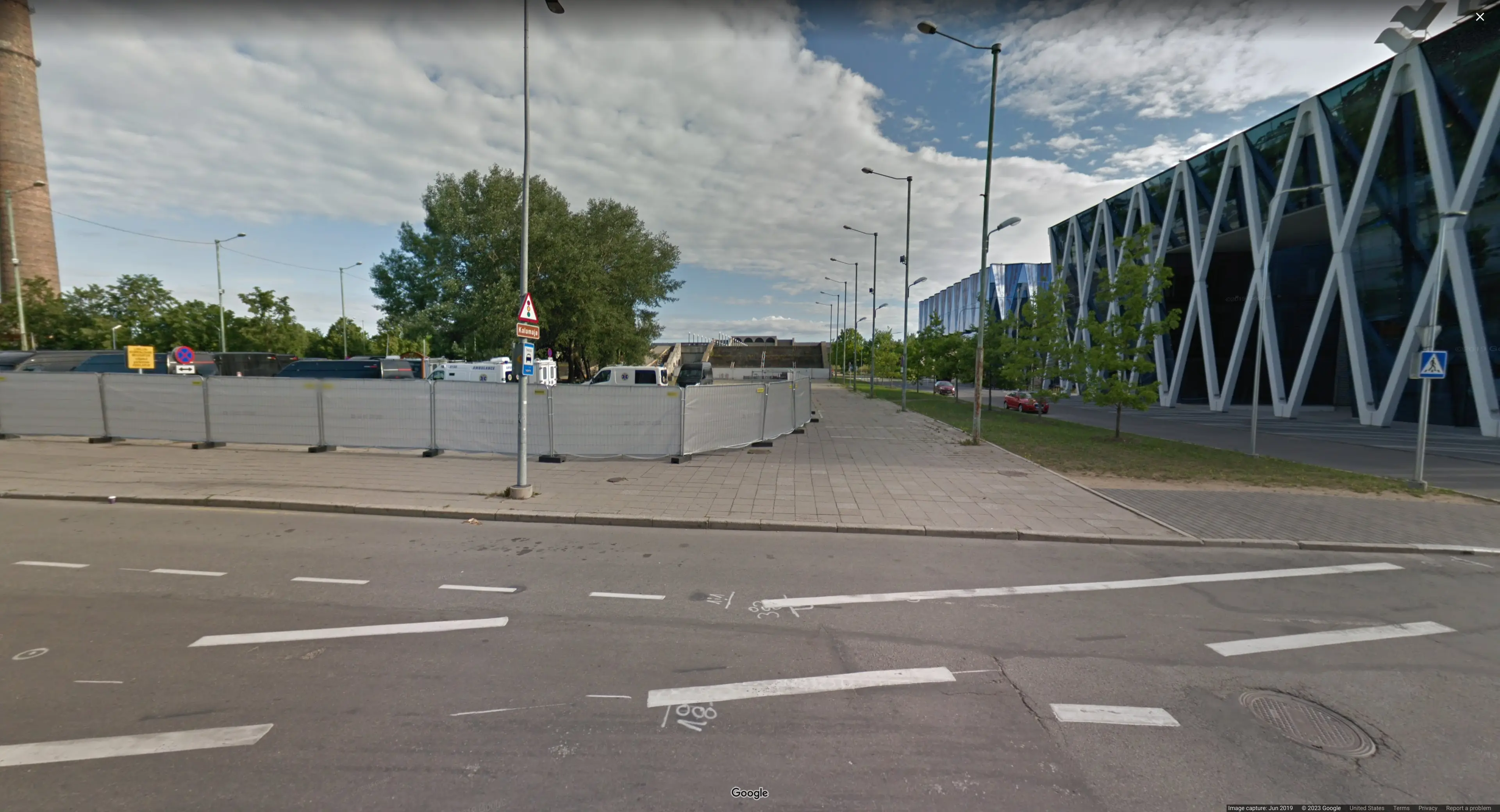
Another very unassuming picture but the following steetsign is readable when zoomed in
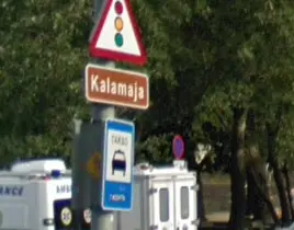
Googling for “Kalamaja” yields results for a district in Talinn, Estonia. Exploring in google maps’ satelite view on the lookout for the structure in the background gives the precise location.
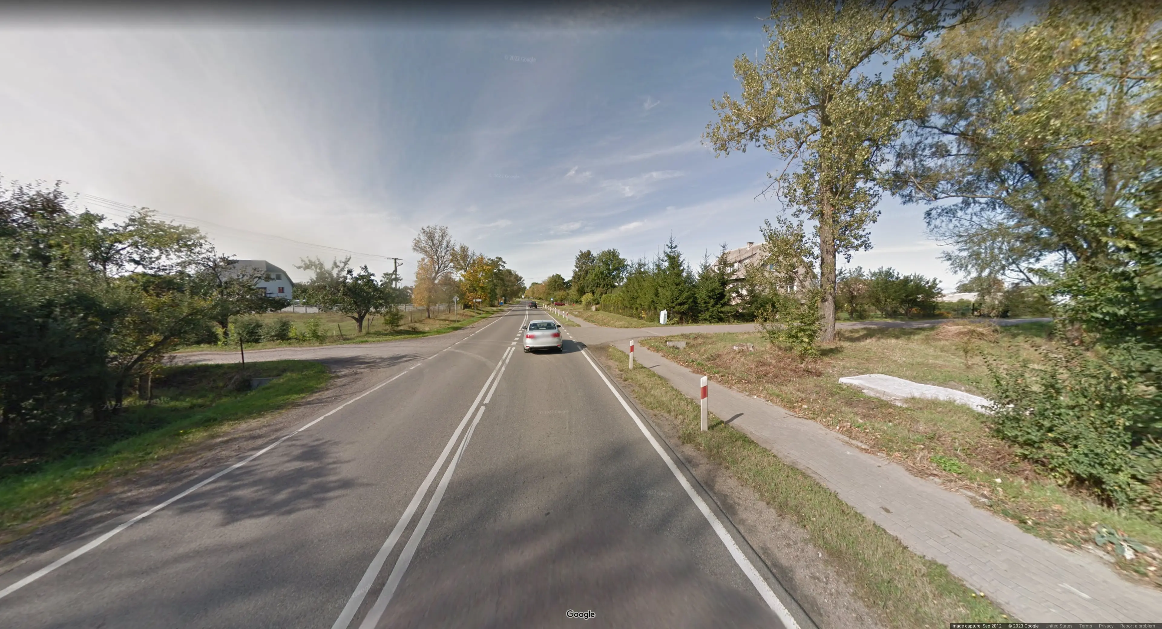
6.png
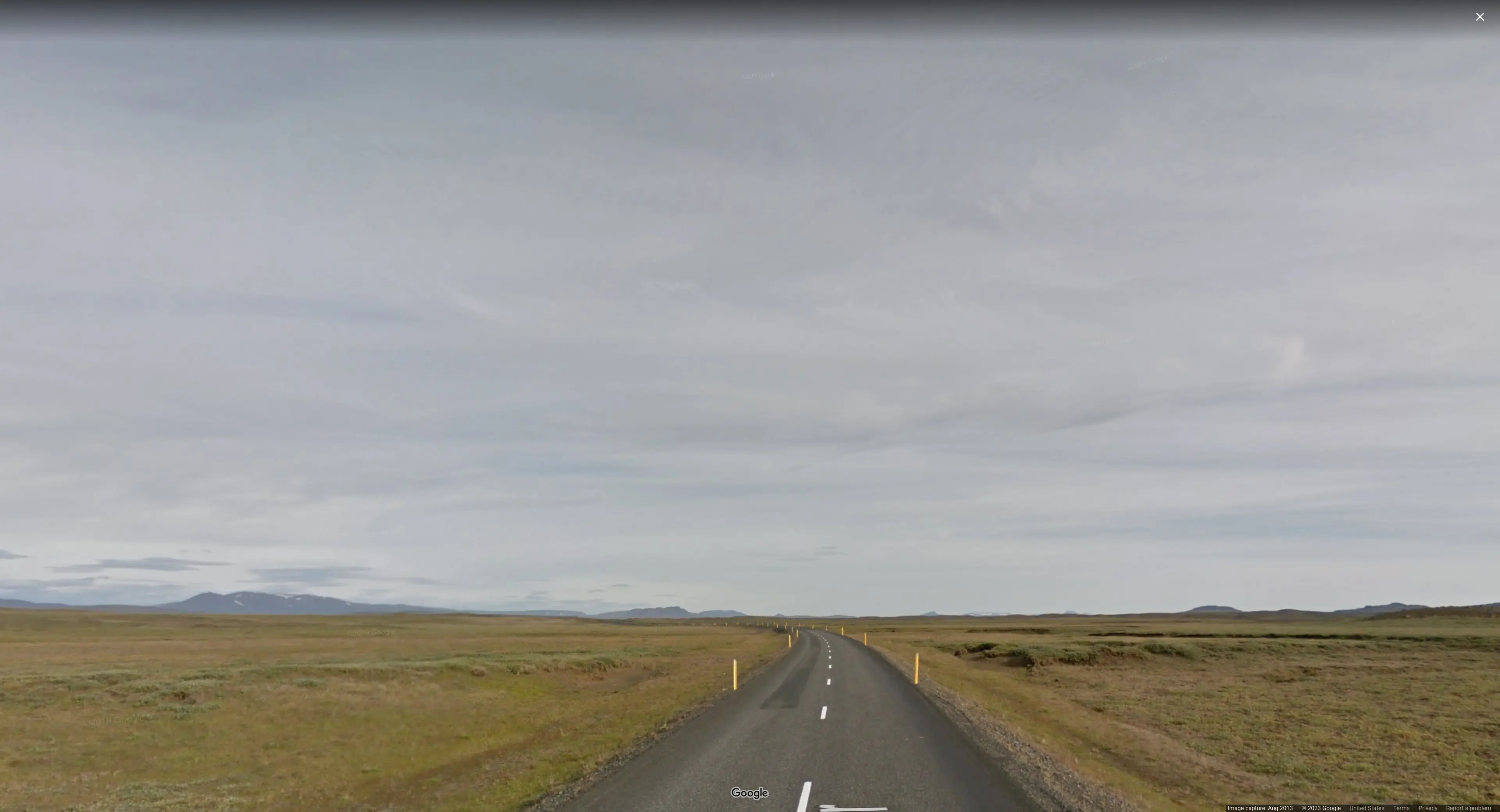
This one must be iceland because of the yellow bollards and the surrounding nature.
9.png
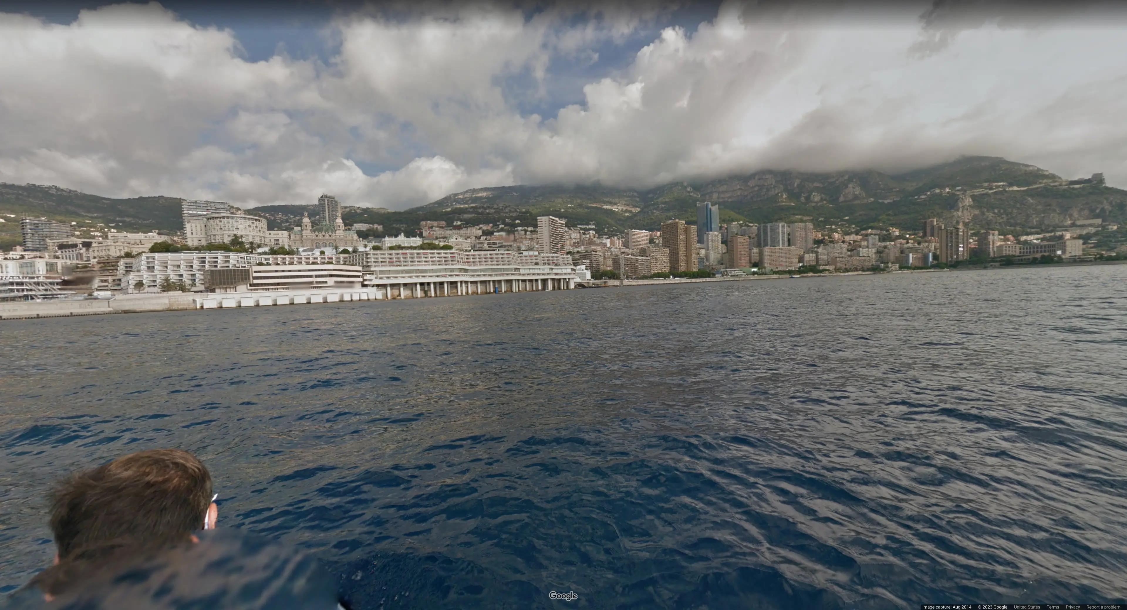
My brother said that the vegetation in the picture would give off “south european vibes”. A quick google reverse image search confirms his hunch. The picture was taken in Monaco. We found pretty much the exact location.
10.png
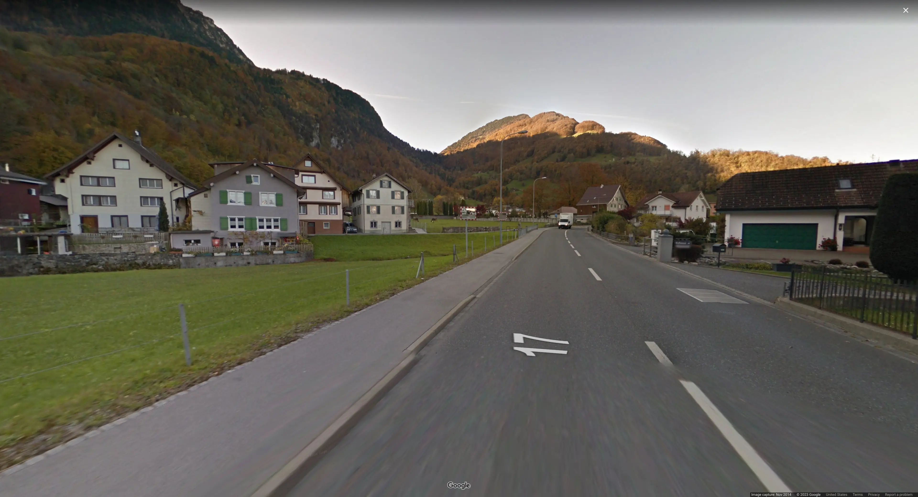
Computer, Enhance!
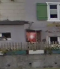
Clearly that is a suisse flag. The country must be Switzerland then!
11.png
Here the bollards give it away.
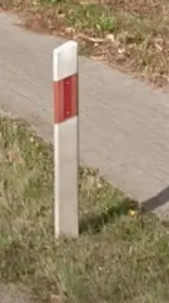
The red diagonal stripe is unique to poland.
12.png
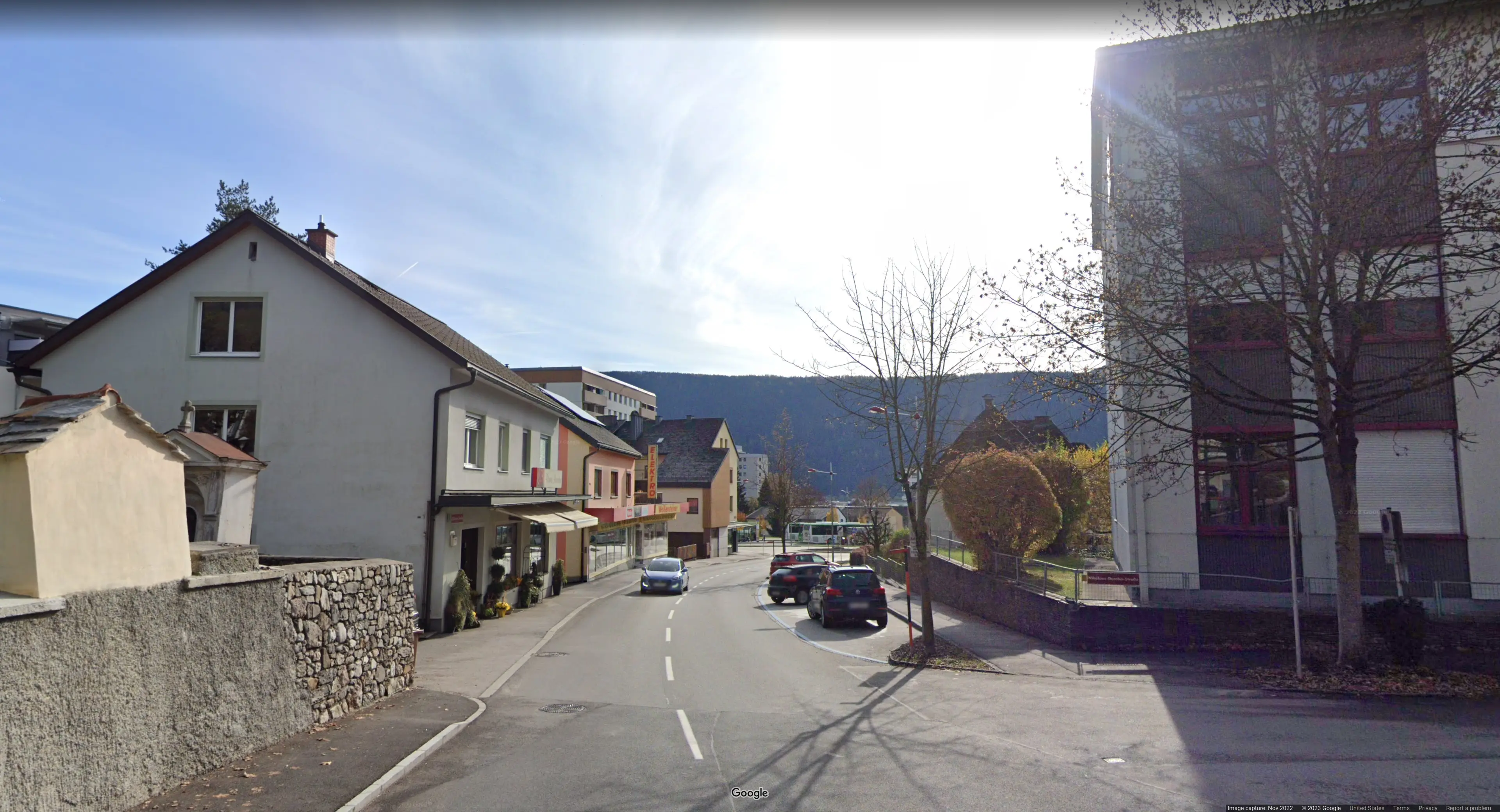
In the Picture a streetsign is visible:
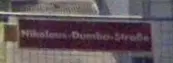
It is hard to make out but it reads: “Nikolaus-Dumba-Strasse”. Googling for it gives a location in Austria.
Mostly Guesswork
Let’s review some of our current progress in figuring out the flag:
| Picture | Country | Letter |
|---|---|---|
| 1.png | Brazil | B |
| 2.png | Russia | R |
| 3.png | Estonia | e |
| 4.png | ??? | ? |
| 5.png | ??? | ? |
| 6.png | Iceland | _ |
Now operating under the assumption the challenge author is not cruel and the flag actually spells out a sensible english phrase, we googled for a list of 5 letter words with prefix “Bre” giving
- bread
- breed
- break
and some more which are not in common use in English.
We couldn’t imagine “breed” as the first word in the flag string, so this leaves us with “break” or “bread” which have the letter ‘a’ in common. The 4th picture:
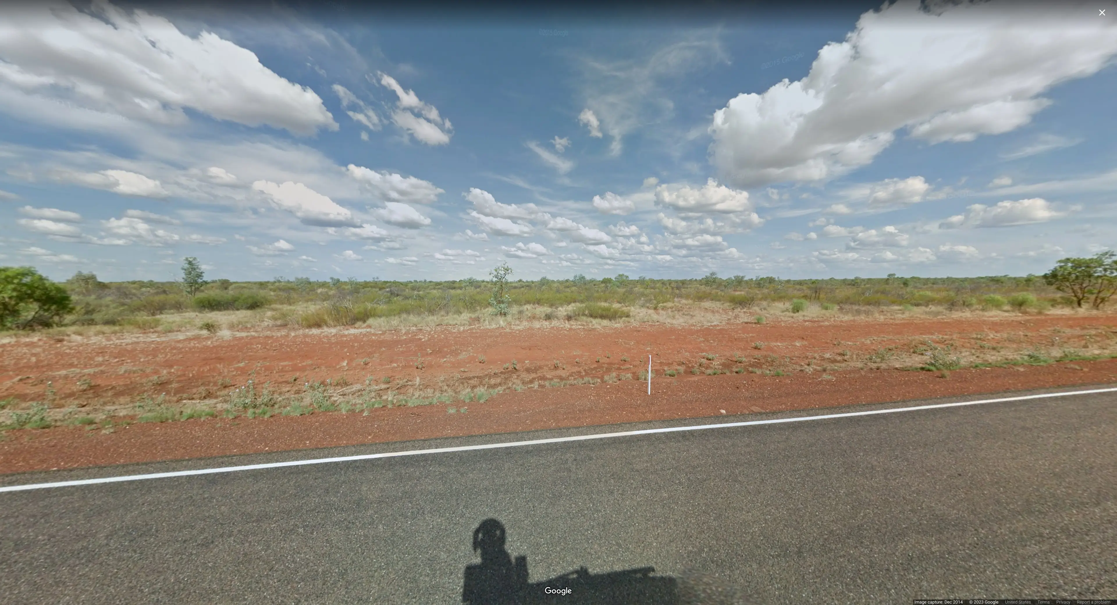
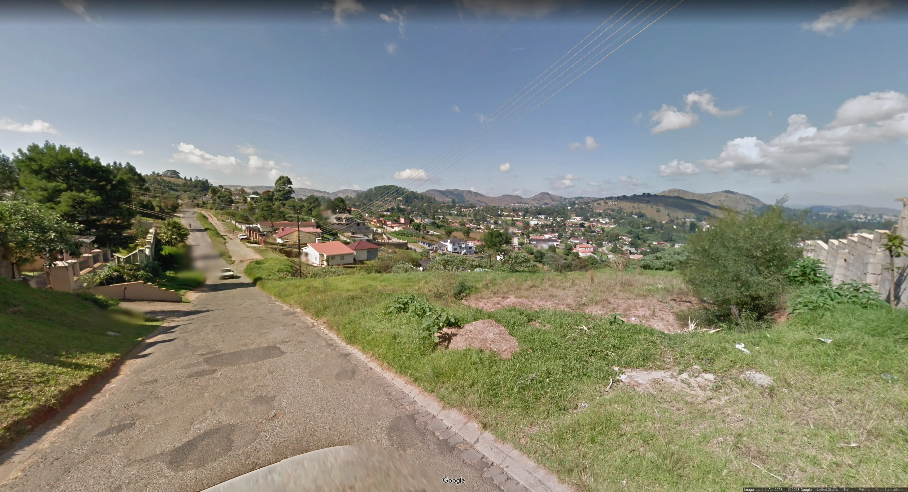
we could not identify at first but with the information that the country might start with an a, Australia seems like a very plausible choice. Especially because of the soil, my brother tells me.
13.png
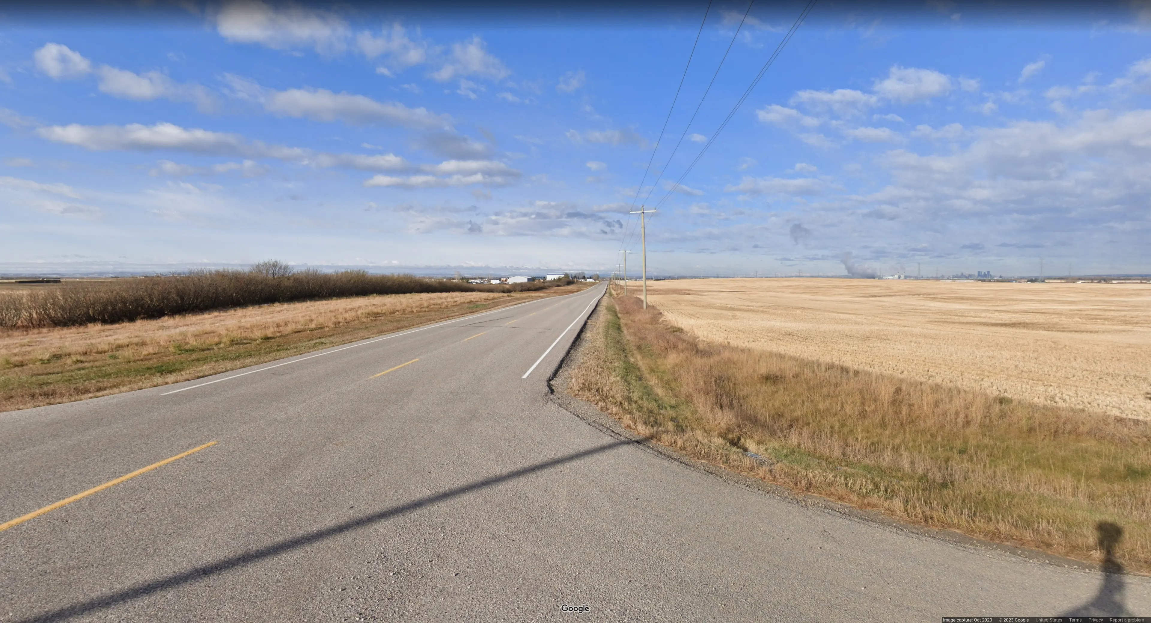
Can not say for sure but me and my brother agree: The vibes are USA or Canada.
15.png
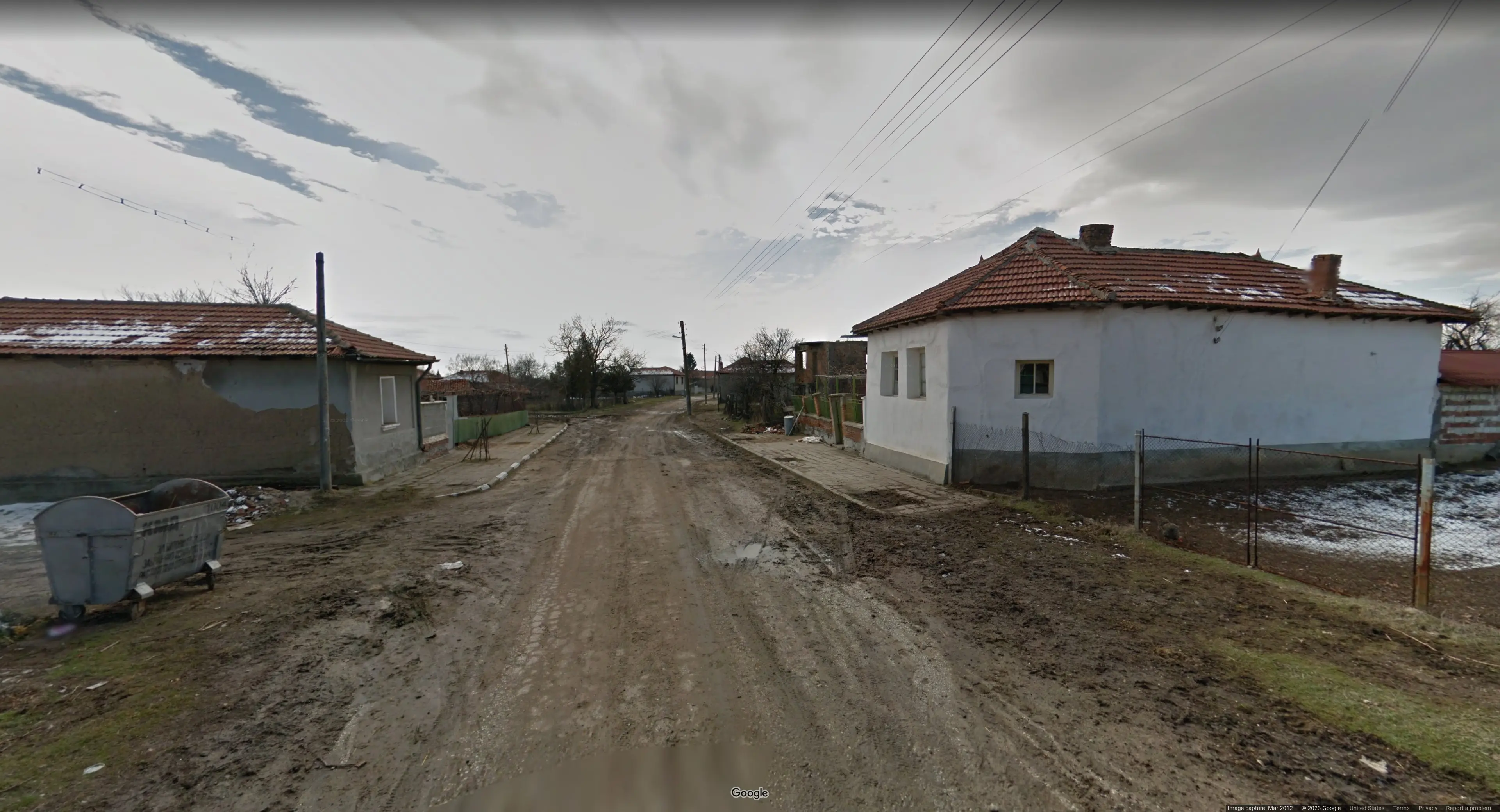
Snow and dirt that could be Bulgaria or Hungaria. That is what my brother tells me!
8.png
My brother’s intuition is that this is Eswatini.
16.png
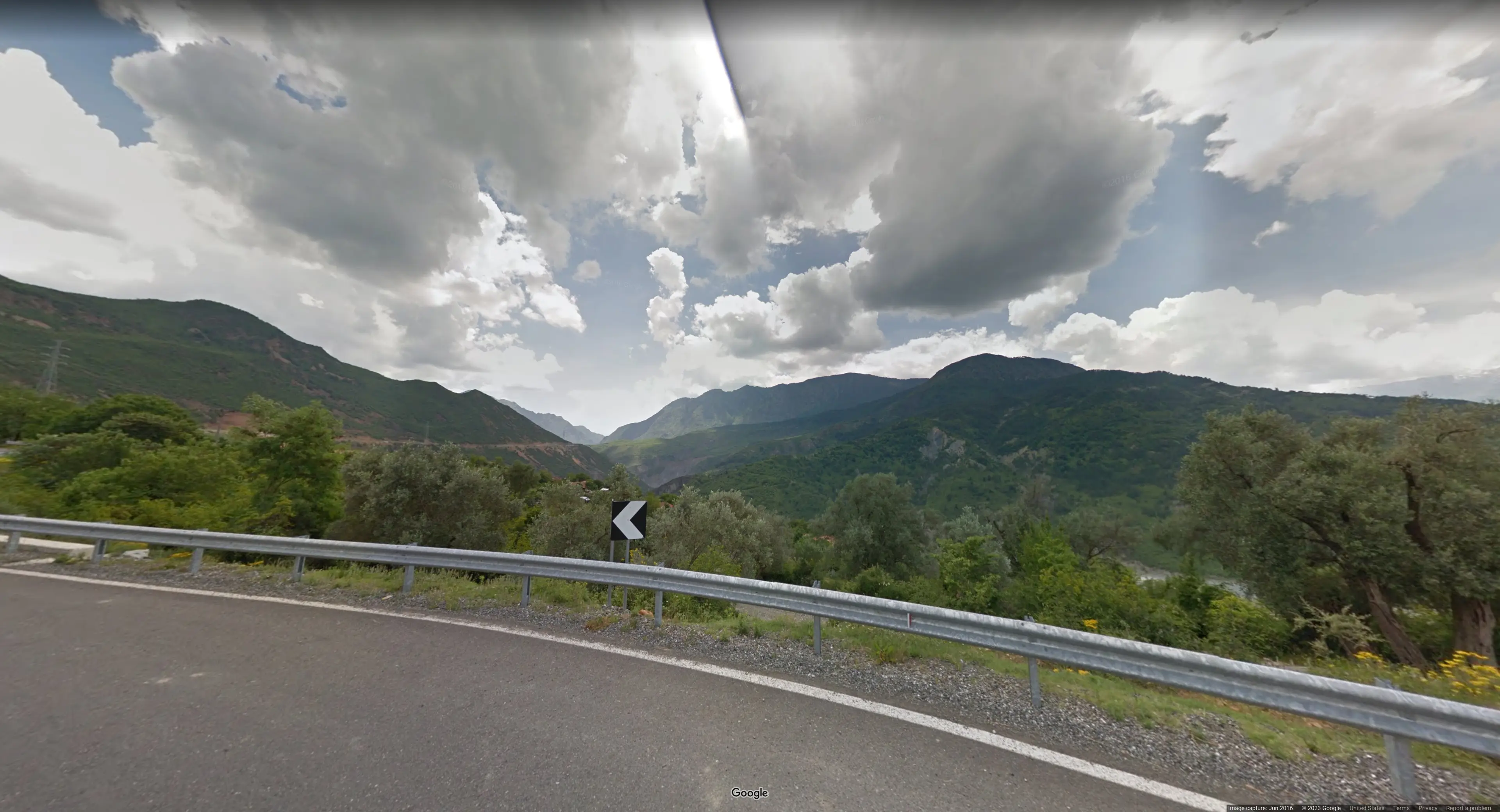
The rift, visible at the top of the image could be indicative of Albania or Senegal according to this guide, as well as my brother.
Let’s review our current progress in figuring out the flag:
| Picture | Country | Letter |
|---|---|---|
| 1.png | Brazil | B |
| 2.png | Russia | R |
| 3.png | Estonia | e |
| 4.png | Australia | A |
| 5.png | ??? | ? |
| 6.png | Iceland | _ |
| 7.png | ??? | ? |
| 8.png | Eswatini? | ? |
| 9.png | Monaco | _ |
| 10.png | Suisse | s |
| 11.png | Poland | P |
| 12.png | Austria | a |
| 13.png | Usa/Canada | ? |
| 14.png | ??? | ? |
| 15.png | Bulgaria/Hungary | ? |
| 16.png | Albania/Senegal | ? |
| 17.png | ??? | ? |
So far we have something along the lines of B R E a ? _ ? ? _ s P a ? …
There are only very few english words with prefix “spau”. This makes Canada the obvious choice for 13.png. Now a lot of english words that have the prefix “spac” also have the prefix “space”.
So it is reasonable guess that the country of 14.png:
14.png
must start with an e. Possible countries that have Streetview Coverage are then
- Ecuador
- Egypt
- Estonia
- Eswatini
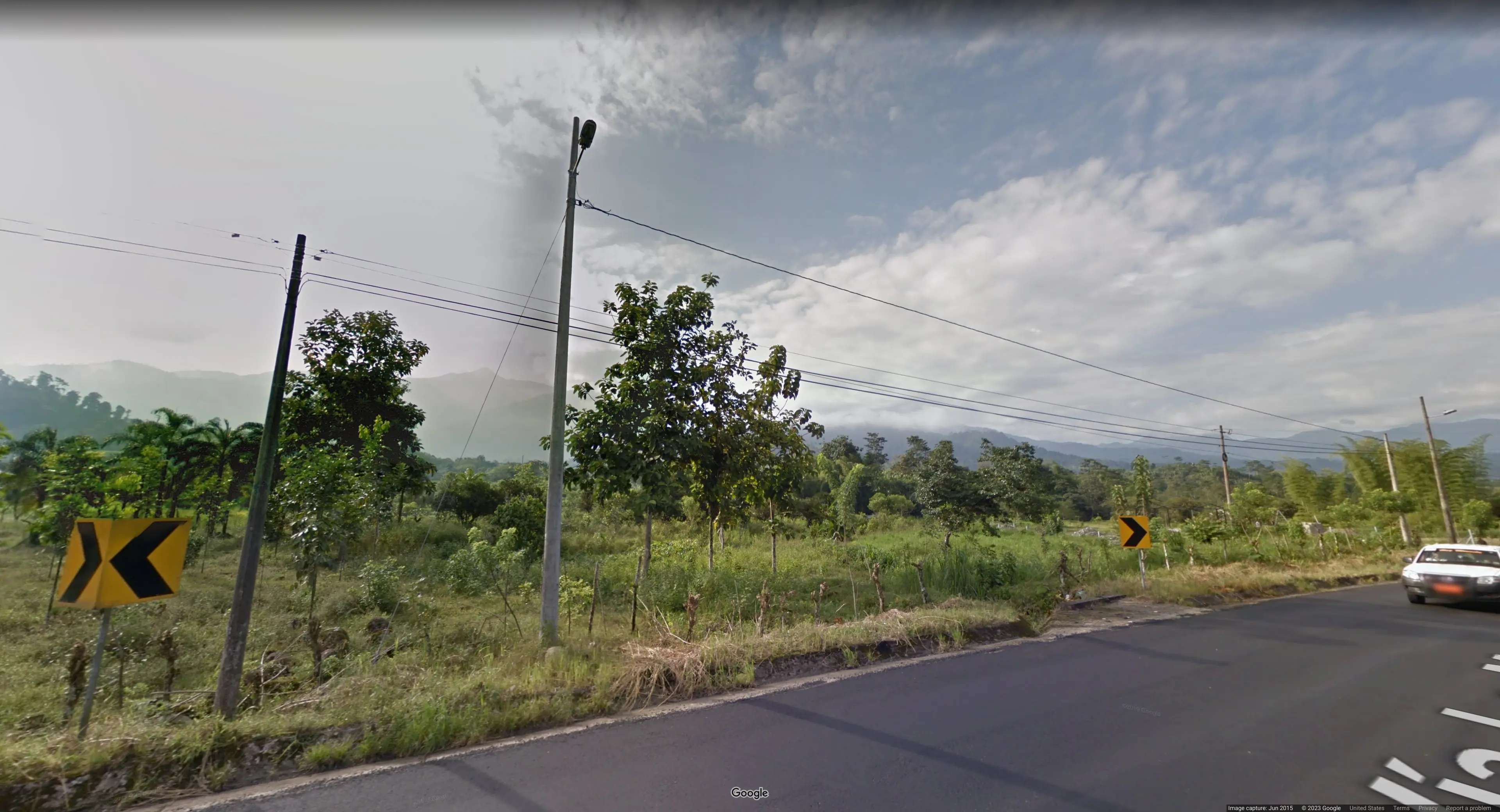
Out of these ecuador is known to have the yellow road signs visible in the picture. So, Ecuador is our pick for 14.png.
At this point we started speculating what the flag could spell out! Remember that up to now we have
B R E a ? _ ? ? _ s P a C e … This gave us the idea that the flag might be referencing the spacebar, rainbolt litterally is SMACKING and POUNDING when entering his guesses. Not only would this align with the hunches we have for pictures 15 and up but also it would then make so much sense that the first word is ‘break’. With this assumption in hand, the fifth picture:
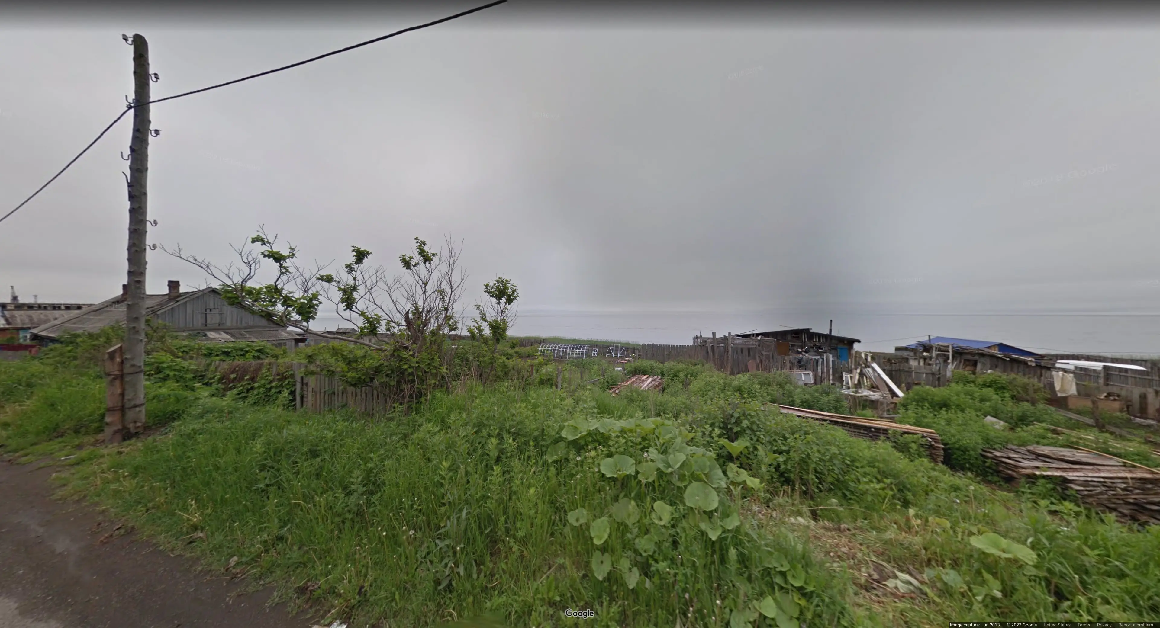
5.png
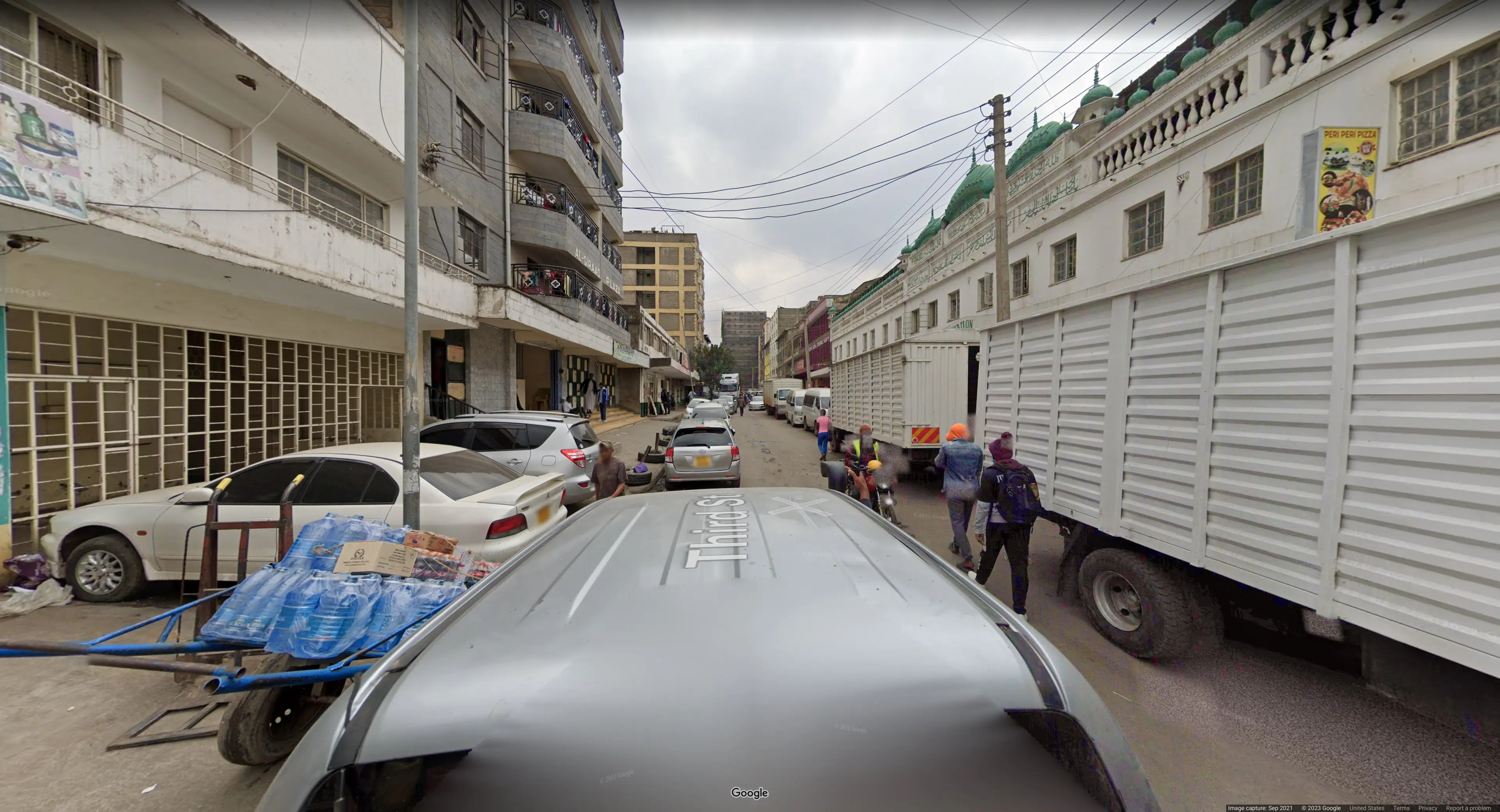
must be taken somewhere in a country starting with K. We spent a long time searching in Kuwait but it ended up being Kenya. My brother even found the facebook account of the “Al Siraad Plaza” visible in the picture which conviently had the exact location linked. Find the exact streetview here.
17.png
Under the assumption that the last word in the flag spells spacebar, the last country for picture 17.png must start with ‘R’.
Possible countries that have Streetview Coverage are then
- Russia
- Reunion (not really a country)
- Romania
Both Russia and Romania have population greater than 10 million, so it is safe to say the the last letter is a capital R.
Let’s review our current progress:
| Picture | Country | Letter |
|---|---|---|
| 1.png | Brazil | B |
| 2.png | Russia | R |
| 3.png | Estonia | e |
| 4.png | Australia | A |
| 5.png | Kenya | K |
| 6.png | Iceland | _ |
| 7.png | ??? | ? |
| 8.png | Eswatini? | ? |
| 9.png | Monaco | _ |
| 10.png | Suisse | s |
| 11.png | Poland | P |
| 12.png | Austria | a |
| 13.png | Canada | C |
| 14.png | Ecuador | E |
| 15.png | Bulgaria | b |
| 16.png | Albania | a |
| 17.png | Romania/Russia | R |
All that is left is to figure out are 7.png and 8.png forming the two-letter word in the middle. This took by far the longest time! We thought
7.png
would be somewhere in South America. As there are not many sensible two-letter words in the english language, we resorted to submitting possible combinations to the ctf-platform that make sense in the context of the pictures.
We suspected Mexico for 7.png for the longest time because with it you could form the words “my” or “me”. However submitting any of the following gave an incorrect flag:
idek{BReAK_Me_sPaCEbaR}idek{BReAK_My_sPaCEbaR}
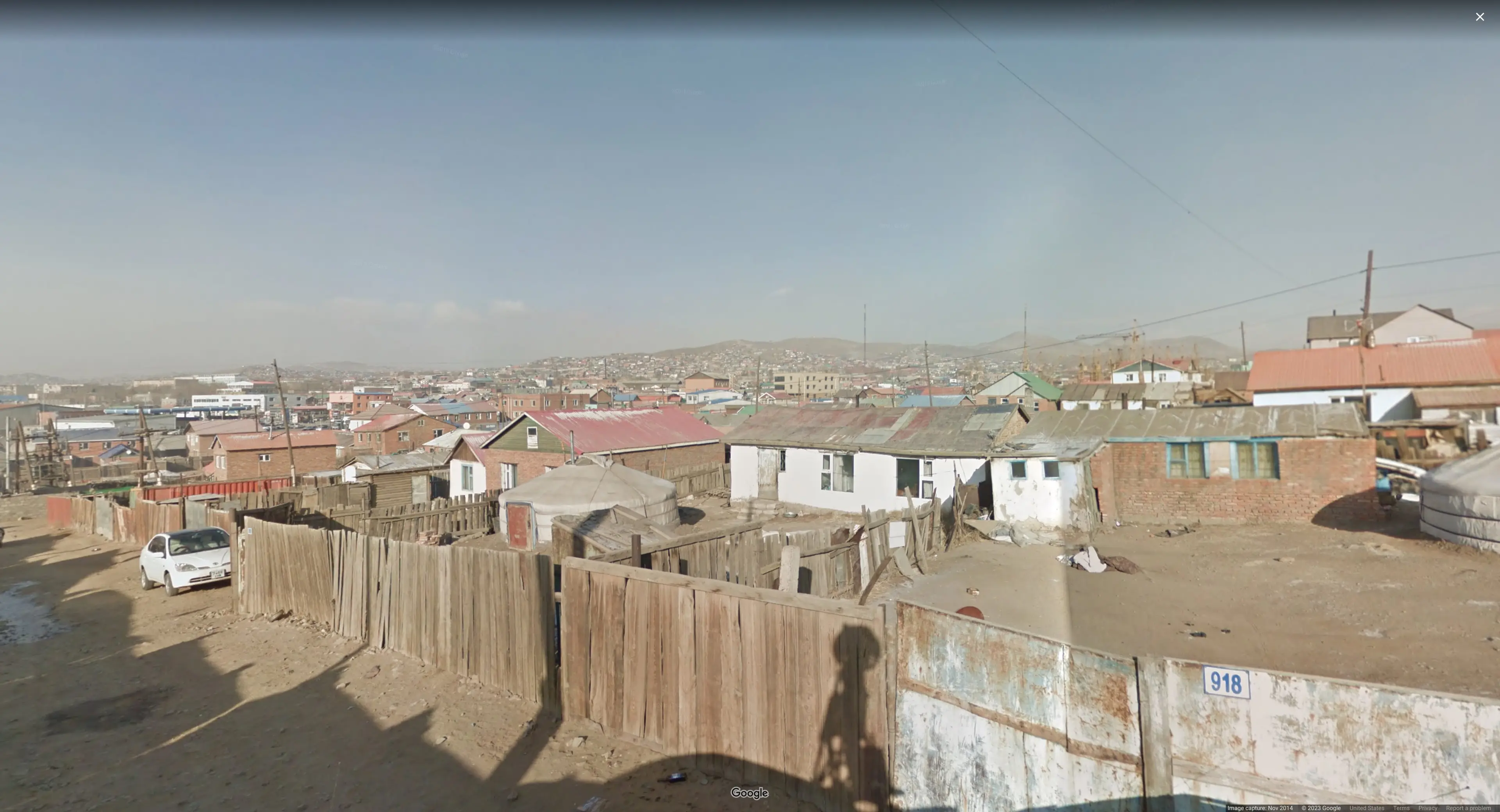
After long, my brother finally had the idea that 7.png could be Mongolia! After all, crossreferencing the visible license plate in the picture with ones commonly found in Mongolia checks out. And sure enough the following is accepted by the challenge platform:
idek{BReAK_me_sPaCEbaR}This implies that the country for picture 8.png must start with an ‘e’. Turns out my brother’s initial hunch for 8.png was correct. It was Eswatini!
Closing Words
Thanks for reading this far. Overall, this was a very fun challenge. On top of learning new geoguessr strats, I also spent some quality time with my brother. Thank you, Challenge Author!